
Fichier:Philippines relief location map (Palawan).svg

Taille de cet aperçu PNG pour ce fichier SVG : 377 × 377 pixels. Autres résolutions : 240 × 240 pixels | 480 × 480 pixels | 768 × 768 pixels | 1 024 × 1 024 pixels | 2 048 × 2 048 pixels.
Fichier d’origine (Fichier SVG, nominalement de 377 × 377 pixels, taille : 2,21 Mio)
.svg?uselang=fr)
Description
| Description |
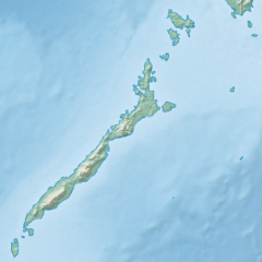
English: Physical location map of the Philippines (Palawan)
Equirectangular projection based on the parallel of 10°43' N
|
| Date | |
| Source | File:Philippines location map (square).svg |
| Auteur | User:Hellerick |
| Autres versions |
Ce fichier est dérivé de : Philippines relief location map (square).svg: .svg) |
.svg)
Conditions d’utilisation
Ce fichier est disponible selon les termes de la licence Creative Commons Attribution – Partage dans les Mêmes Conditions 3.0 (non transposée).
- Vous êtes libre :
- de partager – de copier, distribuer et transmettre cette œuvre
- d’adapter – de modifier cette œuvre
- Sous les conditions suivantes :
- paternité – Vous devez donner les informations appropriées concernant l'auteur, fournir un lien vers la licence et indiquer si des modifications ont été faites. Vous pouvez faire cela par tout moyen raisonnable, mais en aucune façon suggérant que l’auteur vous soutient ou approuve l’utilisation que vous en faites.
- partage à l’identique – Si vous modifiez, transformez, ou vous basez sur cette œuvre, vous devez distribuer votre contribution sous la même licence ou une licence compatible avec celle de l’original.
Historique du fichier
Cliquer sur une date et heure pour voir le fichier tel qu'il était à ce moment-là.
| Date et heure | Vignette | Dimensions | Utilisateur | Commentaire | |
|---|---|---|---|---|---|
| actuel | 26 octobre 2017 à 17:23 | | 377 × 377 (2,21 Mio) | Mliu92 | User created page with UploadWizard |
Utilisation du fichier
Aucune page n’utilise ce fichier.
Usage global du fichier
Les autres wikis suivants utilisent ce fichier :
- Utilisation sur ban.wikipedia.org
- Utilisation sur bcl.wikipedia.org
- Utilisation sur en.wikipedia.org
- Busuanga Island
- Tubbataha Reef
- Calamian Islands
- Puerto Princesa Subterranean River National Park
- Mindoro Strait
- Balabac Island
- Mangarin Bay
- Mount Mantalingajan
- Honda Bay
- Calauit Island
- Rasa Island
- Malampaya Sound
- Delian Island
- Module:Location map/data/Palawan
- Module:Location map/data/Palawan/doc
- Bacungan River
- Utilisation sur fa.wikipedia.org
- Utilisation sur fr.wikipedia.org
- Utilisation sur id.wikipedia.org
- Utilisation sur ilo.wikipedia.org
- Utilisation sur lv.wikipedia.org
- Utilisation sur ml.wikipedia.org
- Utilisation sur si.wikipedia.org
- Utilisation sur uz.wikipedia.org
.svg)